Where the Giants Are, Season by Season
The seasonal maps below combine two things. The colored bands come from the depth grid analysis. The timing, and the idea of where bass go in each season, come from general largemouth behavior and Oklahoma's record-fish dates inference. Water temperatures are rules of thumb; check the gage before you go (station LSDO2 reports water temperature hourly: USACE Tulsa).
| Season | Water temp (rule of thumb) | Months (typical) | Where | Top spots |
|---|---|---|---|---|
| Winter | under 50°F | Dec–Feb | 25–55 ft on steep main-lake structure | 1, 2, 3, 4, 5 |
| Pre-spawn | 50–60°F | late Feb–Mar | 8–20 ft on points and riprap | 1, 2, 3, 4, 5 |
| Spawn | 60–70°F | Apr–early May | 1–7 ft in protected coves | 26, 29, 33, 37, 39 |
| Summer | 75°F+ | Jun–Sep | 15–30 ft ledges, the ridge, the dam | 1, 2, 3, 5, 6 |
| Fall | cooling from 75°F | Oct–Nov | creek arms and coves, following shad | 1, 2, 26, 29, 33 |
Summer thermocline
A 90-ft lake almost certainly stratifies in summer, and the water below the thermocline (often 20–30 ft by August) can be too low in oxygen for bass inference. Set your graph's sensitivity high and look for the band of clutter where shad and bass stop. Fish at or above it.
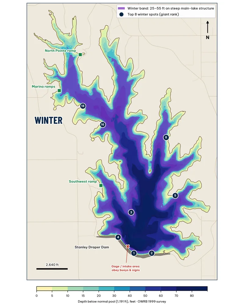
Winter: the purple band is 25–55 ft of water. Badges are the top winter spots by giant rank analysis.
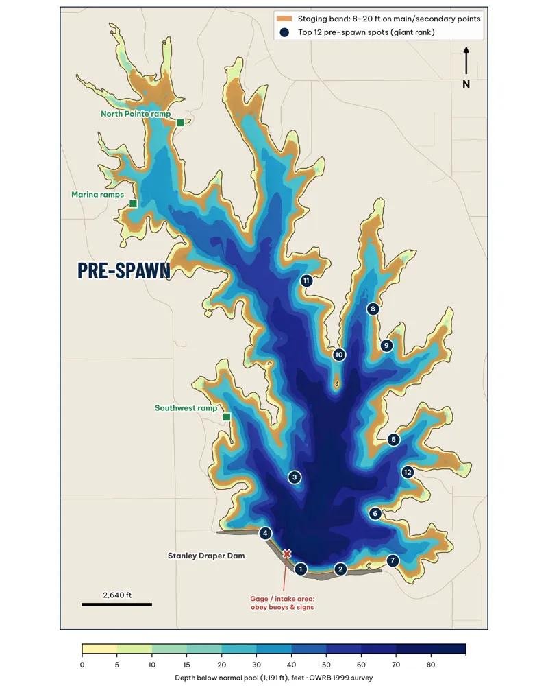
Pre-spawn: the orange band is 8–20 ft on main-lake and secondary points. Oklahoma's heaviest bass have come from late February to the end of March (ODWC Top 20).
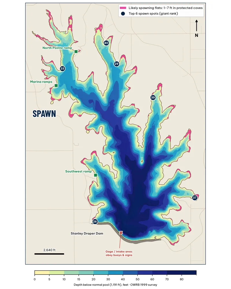
Spawn: pink marks 1–7 ft flats in protected coves, from the grid analysis. Whether those flats are hard sandy clay or soft mud isn't in the survey unverified. OWRB describes the lake bottom as "generally sandy clay" (OWRB 104(b)(3)).
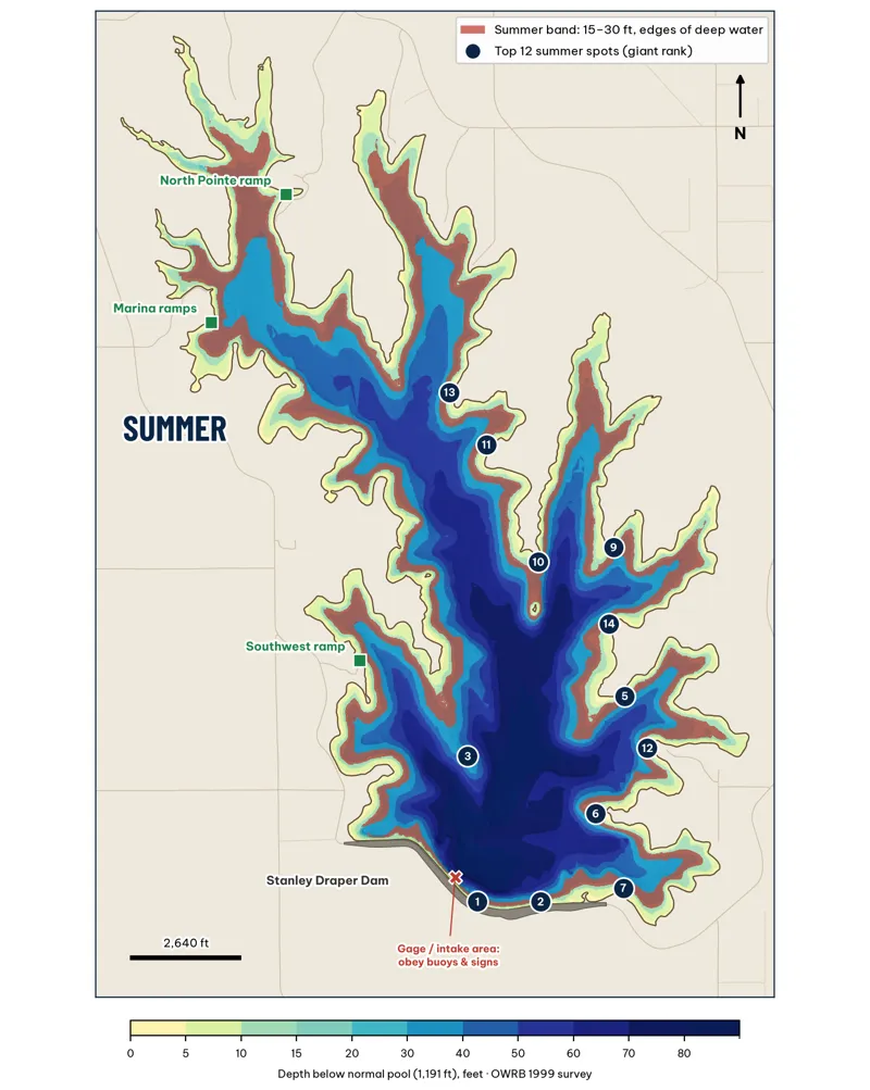
Summer: the red band is 15–30 ft at the edge of deep water. Summer drawdown of 3–6 ft makes every depth on the map shallower (OWRB).
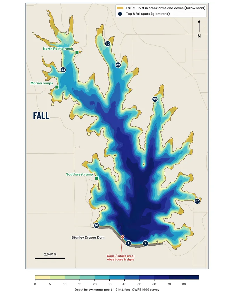
Fall: gold marks 2–15 ft water in the arms and coves, where shad move as the water cools inference.