Interactive Whole-Lake Map
All 40 spots on OpenStreetMap. Marker color shows the giant score; the top 10 show their rank. Tap a marker for the spot and a link to its card. Waypoints are computed from the 1999 survey grid; check them on your graph analysis. Not a navigation chart.
under 6060–6970–7980–8990+
Whole-lake depth map
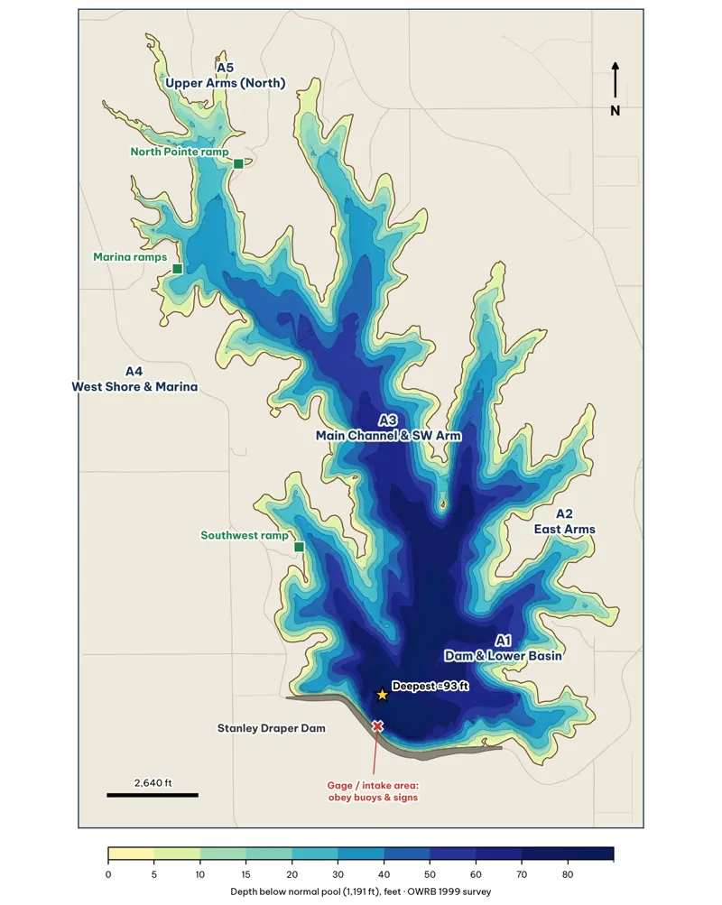
Depth from my 15-ft grid of OWRB's 1999 survey analysis.
Fold-out map
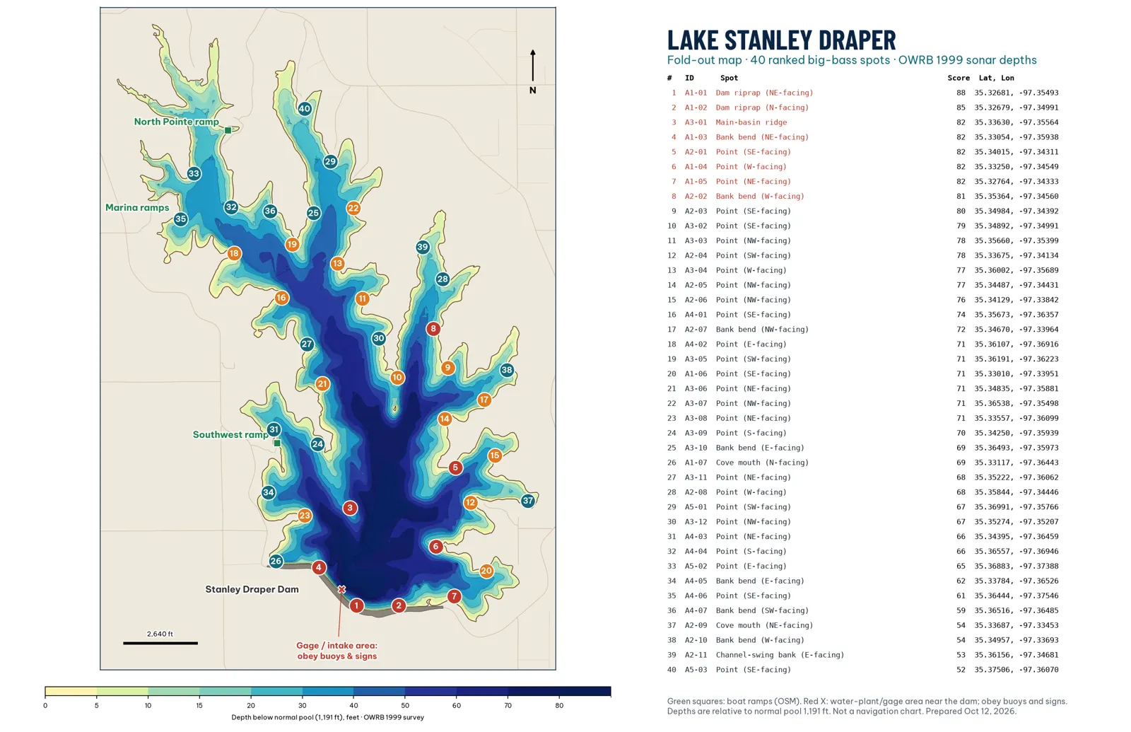
Giant spots, ranked
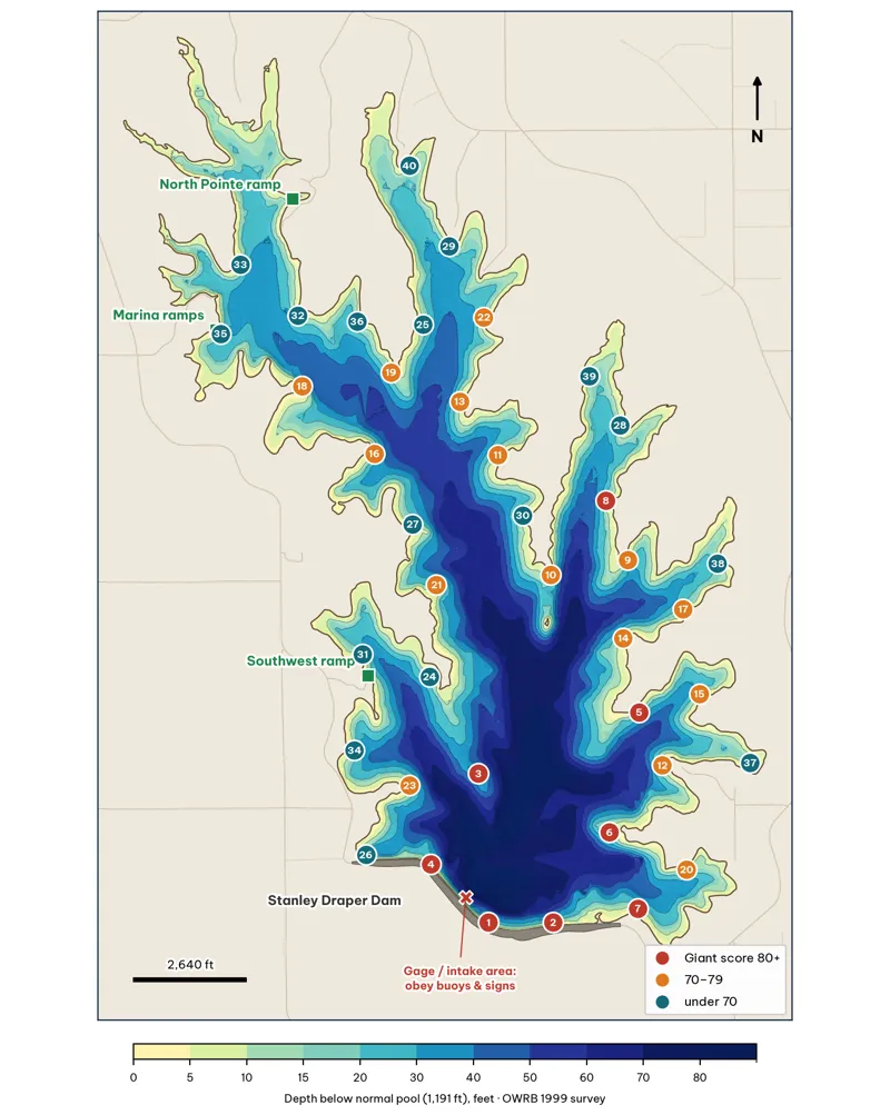
See the full ranking.