Landing giants · 8 lb and up · whole lake
Lake Stanley Draper
Big Bass Guide
Oklahoma City's deep pipeline reservoir: five areas, 40 spots ranked for giant potential, mapped from the Oklahoma Water Resources Board's 1999 sonar survey.
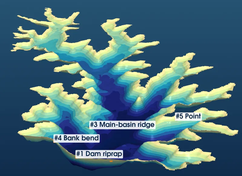
3-D view from above the dam looking north, from OWRB 1999 soundings, depth exaggerated 10×.
2,519acres · 32 mi shore
40spots ranked
93.5 ftdeepest, at the dam
3,495OWRB soundings
Explore
Interactive map40 spots on OpenStreetMapTop giant spotsScored and rankedSpot finderFilter by area and seasonSeasonsWhere giants live, season by seasonRecords & surveyWhat the record really showsLures & techniquesJigs, cranks, swimbaits, spoons, nightRules, water & weatherPermits, hours, level, clarity, windFish careHandling and recording a big one
Quick-reference card
| Top 5 spots | #1 A1-01 dam riprap center (88) · #2 A1-02 dam riprap east end (85) · #3 A3-01 main-basin ridge (82) · #4 A1-03 SW bank bend (82) · #5 A2-01 lower east-arm point (82) |
| Deepest water | 93.5 ft (ODWC/OWRB), in front of the dam; the ridge tops out at ~29 ft with 60+ ft on both sides |
| Records | State: 14 lb 13.7 oz, Cedar Lake, Mar 13, 2013. Draper: no published lake record |
| Giant months | Late Feb–Mar (18 of Oklahoma's Top 20 bass) |
| Winter | Football jig / spoon: #1, #2, #3, #4, #5 |
| Pre-spawn | Jerkbait, crankbait, jig on points and riprap: #1–#5, #9 |
| Spawn | Stick worm in protected coves: #26, #29, #33, #37, #39 |
| Summer | 10-in worm, deep crank, spoon on the ridge and dam; night fishing: #1, #2, #3, #5, #6 |
| Fall | Swimbait / spinnerbait, following shad into the arms: #26, #29, #33, #1, #2 |
| Permits | OK license + OKC fishing permit ($5 day / $20 yr) + OKC boat permit ($6.25 day / $33 yr) |
| Limit | 6 bass, 1 over 16 in |
| Hours | 5 a.m.–11 p.m.; permit holders any time |
| Ramps | Marina (SE 104th), Point 1, Point 21, North Pointe (Rec Area 1) |
| Level | Fills fall–spring, drops 3–6 ft in summer; subtract the shortfall from map depths |
| Phones | Marina (405) 799-0870 · Lake patrol (405) 297-2422 · ODWC fisheries (405) 325-7288 |
The five areas
Area 1Dam & Lower BasinArea 2East ArmsArea 3Main Channel & SW ArmArea 4West Shore & MarinaArea 5Upper Arms (North)
Not a navigation chart
Depths are from OWRB's 1999 sonar survey, gridded by me analysis, and are relative to the 1,191-ft normal pool. The lake drops 3–6 ft most summers, so subtract the shortfall. Depths between survey lines are interpolated.